FloodWaive
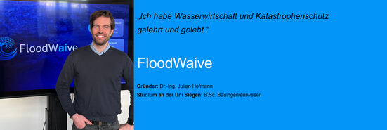
Dr.-Ing. Julian Hofmann is the CEO of FloodWaive Predictive Intelligence GmbH. After earning his Ph.D. from RWTH Aachen University on the topic of flood forecasting combined with physics-based AI methods, he co-founded FloodWaive with computer scientist Adrian Holt in 2023, and together they developed the first physics-informed AI system for flood forecasting. FloodWaive was developed at the Institute for Hydraulic Engineering and Water Resources Management at RWTH Aachen University.
What is FloodWaive?
FloodWaive focuses on flood protection and international forecasting. We combine cutting-edge technologies and specialized algorithms—which we develop in-house—and apply them in real-world scenarios. In doing so, new AI models are put directly into operation and tested, for example, in disaster management.
Our team is interdisciplinary and consists of engineers, communication scientists, and, of course, computer scientists with PhDs who are experts in the field; but the team also includes financial accountants and everyone else needed to run a startup.
We aim to strengthen flood protection and disaster management by providing more accurate forecasts for organizations such as fire departments, the Federal Agency for Technical Relief (THW), and the German Armed Forces. This means that if flooding were to occur in the Siegen-Wittgenstein district in the future—which we certainly hope will not happen—we would be ready to deploy such technologies.
How does AI-powered flood forecasting work?
First, you have to measure something in an environment so that you can incorporate that measurement into the forecast. We use sets of physical equations. This is a digital twin. You have a terrain model, including buildings, bodies of water, and the ground. Using appropriate calculation models, we determine the amount of precipitation that falls. Then we calculate how quickly and how much the water spreads—and, most importantly, which areas are affected. We also have access to all the building IDs and can therefore perform what’s known as impact forecasting. This allows us to predict the effects—for example, which buildings the water will reach. All of this is achieved through a combination of physical and mathematical models and AI. That’s why it’s called a “physics-informed neural network” or “physics-informed AI.”
Who are your customers?
We work at the municipal, district, and state levels. We developed the “Flood App for Homes” for the Ministry of Home Affairs, Municipal Affairs, Construction, and Digitalization of the State of North Rhine-Westphalia. If you Google it and enter your address, you can see your own building and determine how severely you’ll be affected.We’re also active throughout Germany. However, most of our projects are in North Rhine-Westphalia. We’re also working in the Netherlands, Austria, and Switzerland, and will soon be expanding to England. We’ve already made initial contacts in India and will very likely offer similar products there as well.
Have you seen any success so far?
Yes. Before, very few citizens were even aware of hazard maps, heavy rain hazard maps, and flood hazard maps. They didn’t know whether they themselves were at risk and, if so, what to do. Through this app, which we developed on behalf of our state and which has now been accessed several million times, we’ve created a whole new level of understanding and awareness. When you can enter your address and see your building displayed in 3D, it creates a completely different perspective. Soon, the app will also provide information on how to protect yourself and what safety measures to take. We’re also doing a lot of outreach work in this area.
What makes FloodWaive special?
The technology. The physical AI we’re developing is unique on an international scale. While work is currently underway in many places, there isn’t yet another generalized model like this that can be applied immediately. There are other AI models, but they require a very long training period for a specific area. We’ve incorporated physical and mathematical equation processes—calculated using hydraulic models—into the AI. That’s what makes it so fast and versatile. This saves a lot of money and allows us to move directly into operational use—for example, to work very quickly with emergency management agencies. For instance, there’s a heavy rainfall hazard map for North Rhine-Westphalia. Using conventional methods, it takes about six months to calculate this for the entire state. We can calculate this in just five minutes because we have an acceleration factor of up to 10 to the power of 6. That’s a million times faster than previous methods. And that’s the key USP. The other USP is that we’re also doing a great deal of work on the interface. As a civil engineer, I’ve spent a long time teaching and working in water management and disaster response—and still do to this day—and I’m also very active in the field, which is why we apply this technology exactly where it adds value and addresses the pain points. Our interdisciplinary team ensures that we view the product from different perspectives, which is why we always work closely with the customer. This means we quickly create a so-called mock-up, or a prototype. Only then do we integrate the technology, so that we can develop the product together with the user. That’s why every product is a custom solution.
What prompted the founding of FloodWaive?
I’ve witnessed many such events myself. For example, while I was living in Brazil, I experienced numerous flash floods in both São Paulo and Rio de Janeiro. In Germany, as a scientist, I was personally involved in the 2021 flood in the Ahr Valley, which severely affected us in North Rhine-Westphalia and Rhineland-Palatinate, as well as, of course, in the border regions. Because I used to head the early warning division at RWTH, my phone wouldn’t stop ringing. I received countless calls every day saying that we needed new early warning systems. Since it’s not possible to develop such systems within a university’s operational framework, Adrian and I decided to establish this as an operational company so that we could provide these services.
To what extent did your studies at the University of Siegen (civil engineering/hydraulic engineering) influence your decision to start this company?
I followed in my father’s footsteps; he’s also a hydraulic engineer and held a professorship at the University of Siegen. During my studies, I was very interested in the field of geoinformatics—back then, we also had a course on geographic information systems. I was already very involved with flood protection systems back then. That’s also where I conducted my first flow path analysis—specifically, to determine where hydropower plants, or pumping stations, could be planned. I enjoyed that immensely. This interplay between water and geoinformation systems has continued to shape my work ever since. I also worked in geotechnical engineering at the University of Siegen, where I surveyed flood retention basins using so-called LiDAR systems—a laser scanning method—conducted slope failure analyses, and worked extensively with drones. In addition, I developed new technologies, which I presented at the Geotechnical Engineering Forum in Berlin when I was younger. The Chair of Hydraulic Engineering was also very well-known back then. I know two people who completed their training there and are now working as professors in the U.S.
Were there any challenges when you founded the startup?
Yes, definitely. It was hard at first to focus on the essentials and keep a clear head. But we also received a lot of support, such as the Exist grant for startups from the Federal Ministry for Economic Affairs and Energy.
What is your goal with FloodWaive? / What do you hope to achieve with FloodWaive in the future?
It would be a real added value if we could save lives through this technology. Of course, it would also be great if this technology were adopted in Germany and used to make progress, especially in operational areas such as disaster response and public safety. If we ever have the opportunity to present the technology we’re developing here in the Netherlands—a country with experts in the field of flooding—that would be a special and positive sign. It would also be wonderful if we could work in developing countries. We’ve already received many inquiries from South America and Africa. Applying this technology to development projects there would be fantastic.
This profile is based on an interview with Julian Hofmann and was written by Duygu Cicek.